Wind River Range, August 2022
/In the second half of August 2022, three companions and I went for a walk in the wild, woolly Wind River Range of Wyoming. Time constraints and a realistic appraisal of our own badassery, or lack thereof, led us to choose to execute two of Andrew Skurka’s section hikes (loop 2 and loop 6) rather than his entire High Route.
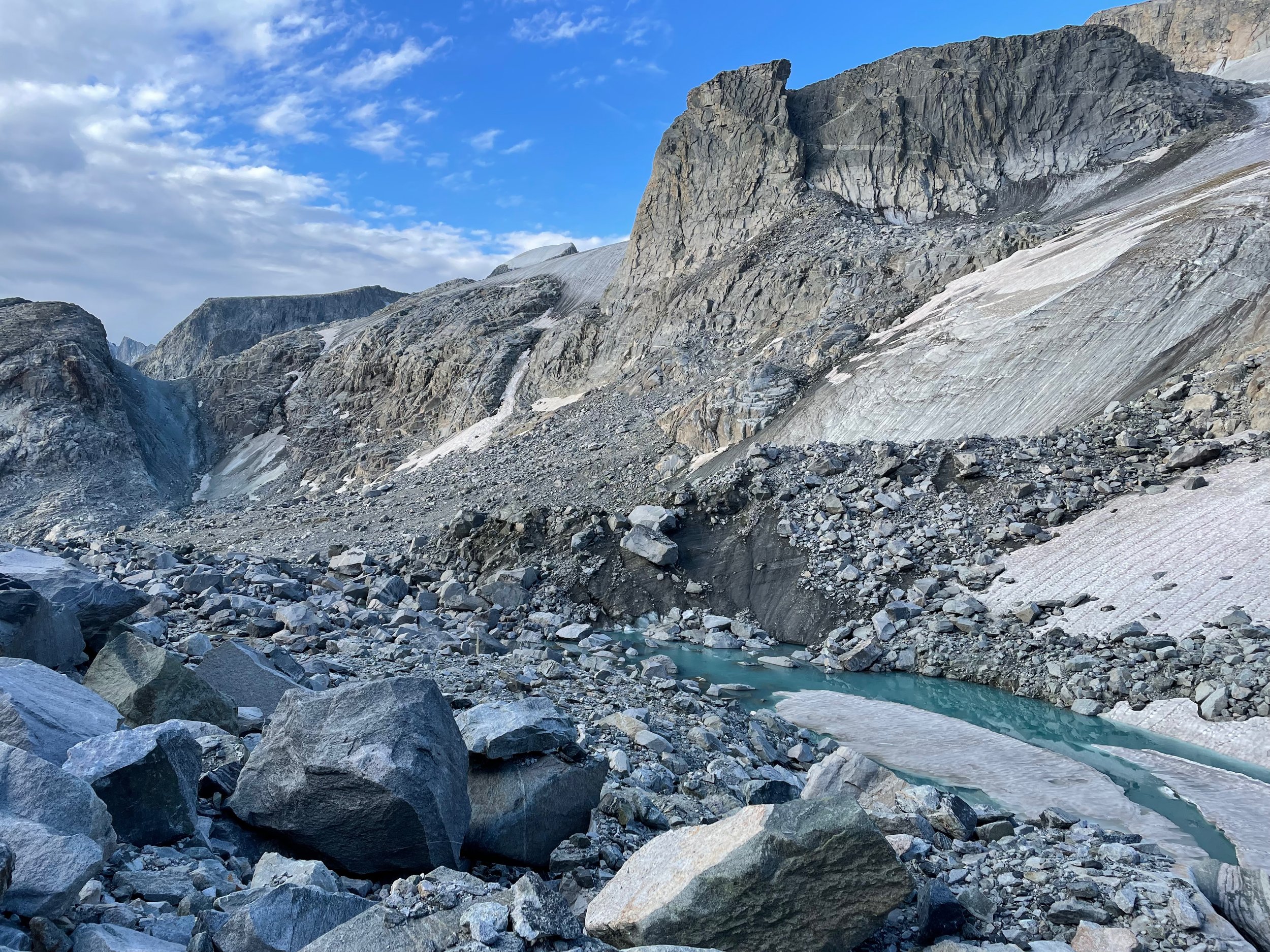
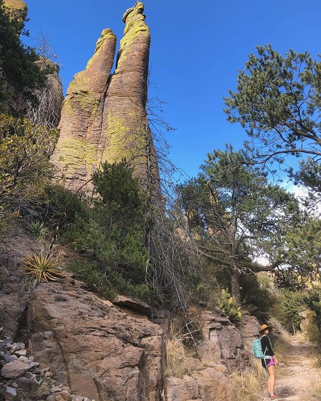
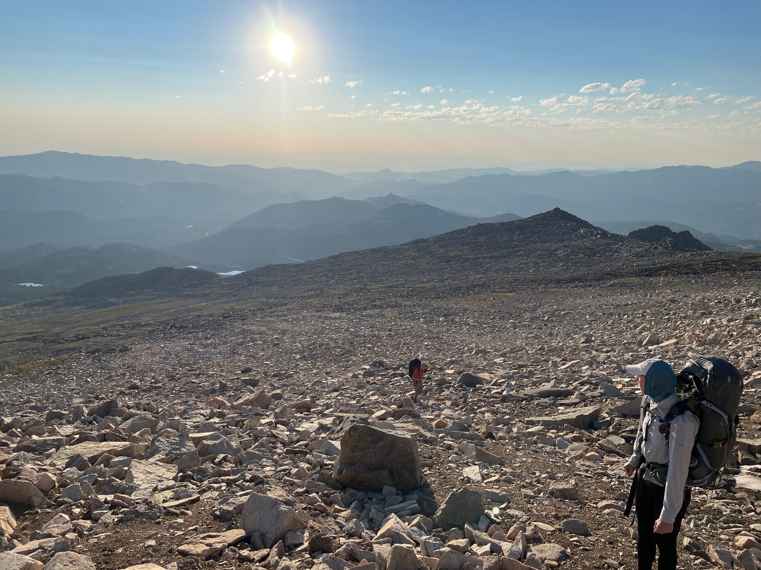
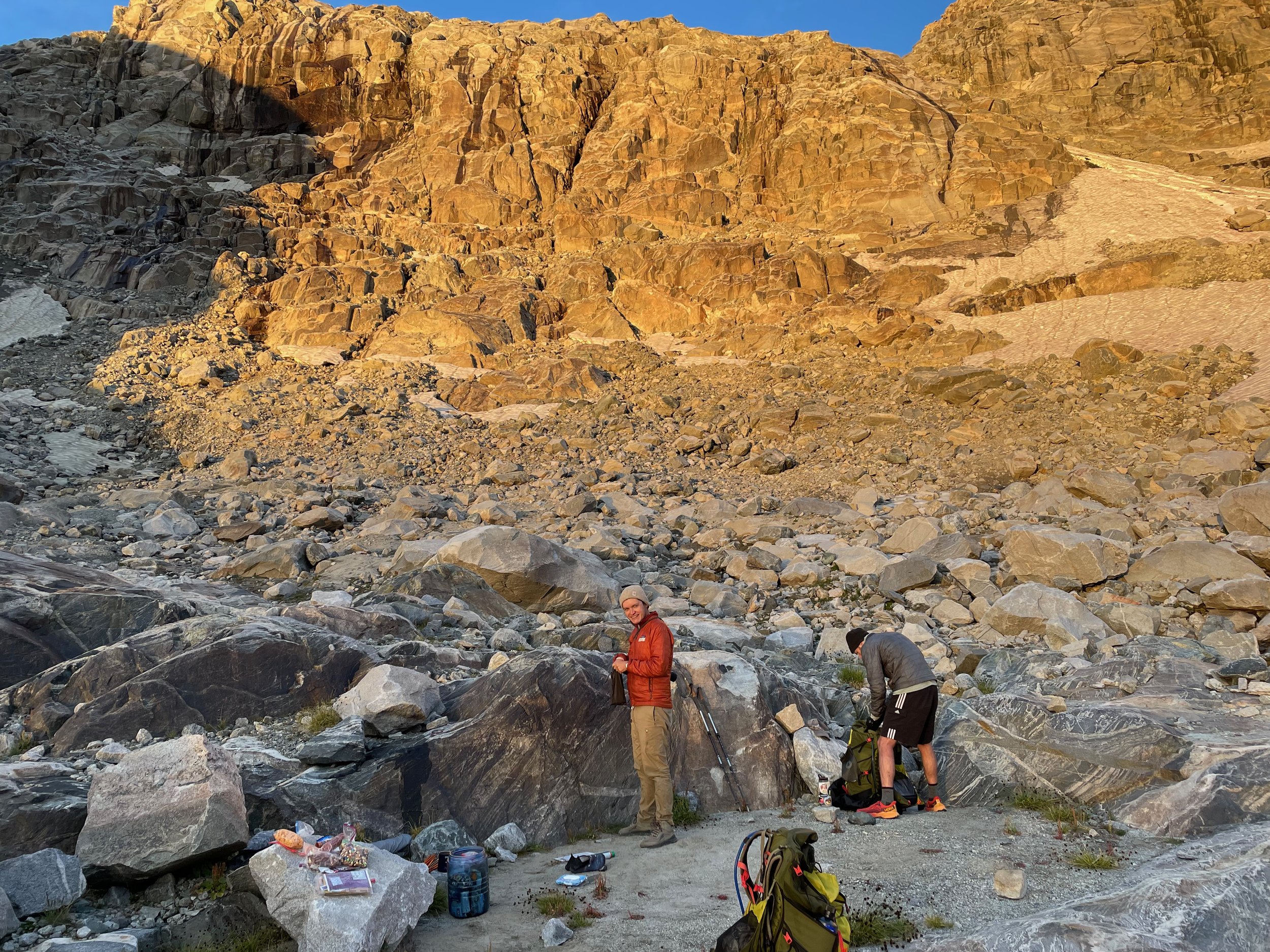
from near the edge of the grasshopper glacier, about two-thirds of the way through our second loop in the north end of the Winds. The “gully” in the left background had been traversed at this point, to give an example of some of the off-trail terrain that one regularly encounters up there.
Hiking partners were:
Eric, living in LA. Some backpacking and climbing experience, no long hikes or mountaineering experience.
Andrew, living in Seattle. Member of an alpining club with some mountaineering and more backpacking experience.
Megan, living in coastal Florida. Had been backpacking once in her life before this.
Yours truly, living in Tucson, multiple long hikes but little experience in off-trail travel and not a climber.
None of us had been in the Winds before and all of us are reasonably fit people but nonetheless were arriving “off the couch” without any specific training or acclimatization.
Loop 2, Day 1
Loop 2 started at the hot, dry, dusty, buggy Big Sandy Trailhead. It was completely slammed in the afternoon on a Monday, and was frankly an ugly place to start a trip that promised such intense natural wonder. I drove in separately from the other three and we all managed to hit the trail at about 2:00pm. Just before setting out, the bugs at the trailhead spurred me to switch from hiking shorts, my de facto choice, to long trousers, and this turned out to be the correct decision in the long run. The trail to Dads and Marms Lake was never steep, easy to follow, generally forested, and the crowds thinned out as we progressed northwestward later in the day. Marms Lake, where we set up camp, was an achingly scenic location at sunset, the beautiful prelude to the sublime Wind River Range high country which we would encounter the next day but hadn’t even glimpsed yet at this point.
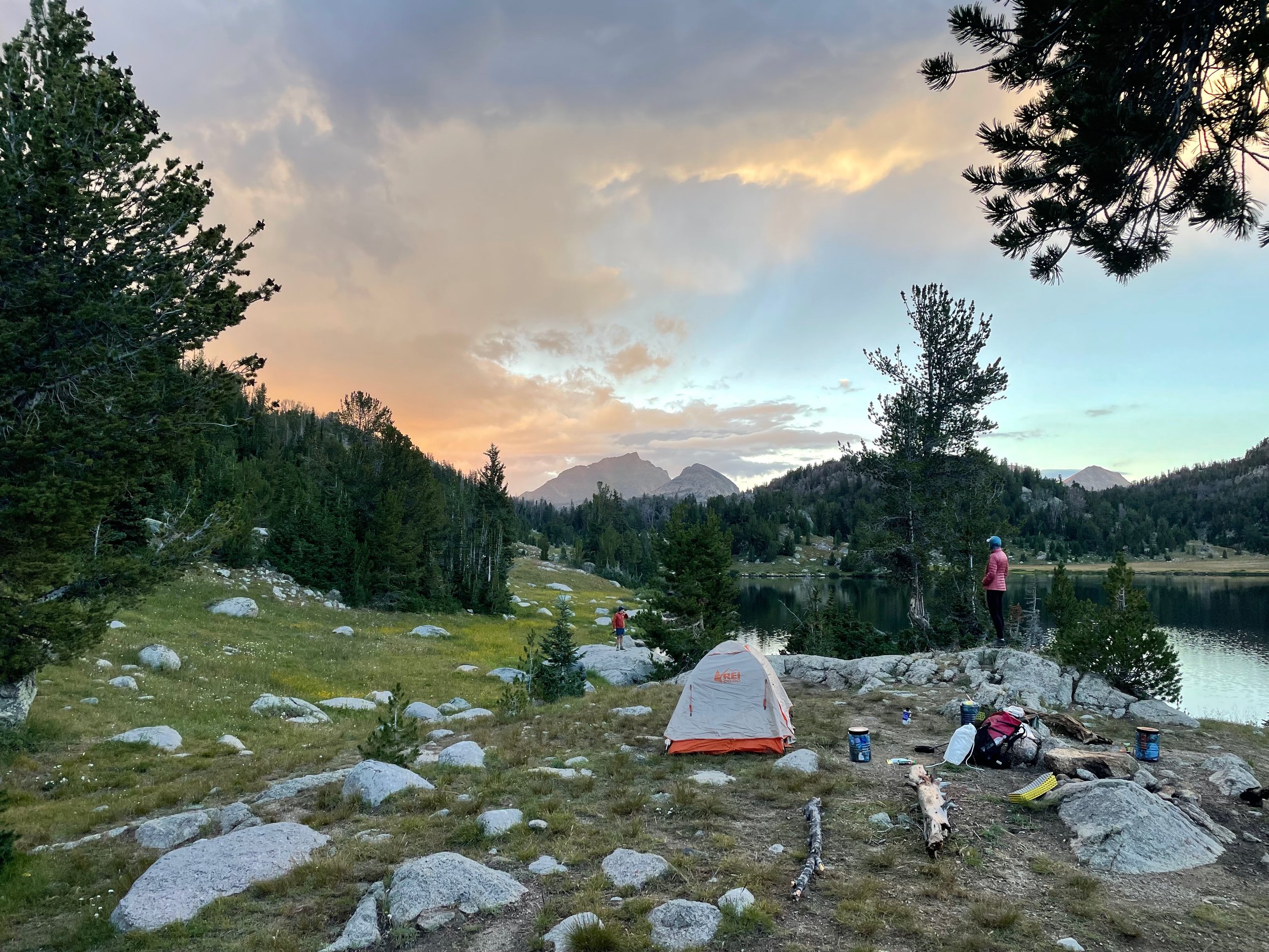
Sunset at Marms. Was it named for dear old marm, or for marmots? A point of debate.
Day 2
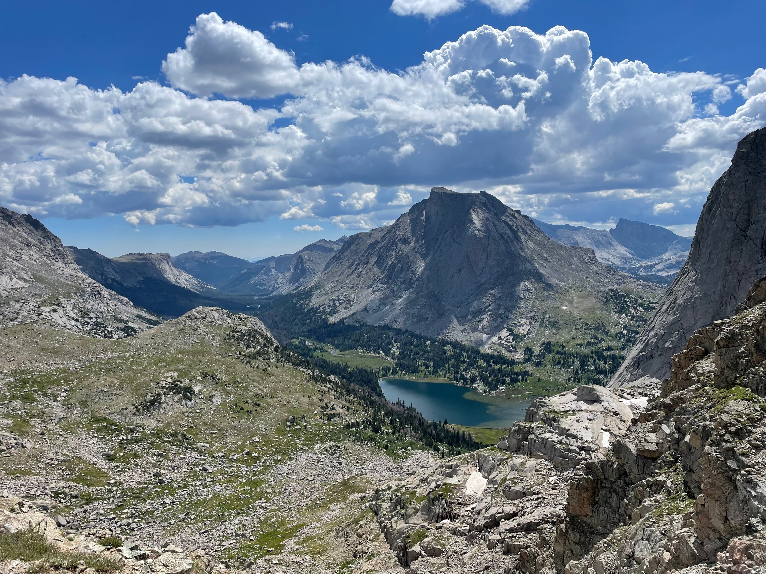
From the top of NY Pass: Looking into the Cirque of Towers, starring Lonesome Lake, Mitchell Peak above it, Jackass Pass to the right and about half of Pingora (Pangolin) to the right of that.
Day 2 began with more of the same: comfortable trail walking as we wrapped around the foothills that had been flanking us the first day, and moved up into the valley formed by Washakie Creek. Reaching Shadow Lake, the official trail ended but the social trail through the trees around the lake was very easy to find and follow, and this eventually spat us out at treeline at the outlet of Billy Lake / Lake 10600, staring at the formidably steep face of New York Pass. At a distance it seemed too barren and steep for humans to get up, much less down, but per Skurka’s notes we chose the gully with the most vegetation and began picking our way up the slope of scree, talus and grass, eventually making it to the top around noon. At the top of the pass, the terrain falls away sharply in both directions, behind to the Washakie Creek and Shadow Lake valley, and ahead to the intensely dramatic Cirque of Towers. It was sunny and quite frankly hot after so much exertion reaching the top, but clouds started to gather before we left. Complicating our decision-making was that, to our uninitiated eyes, the direct route down into the Cirque from the pass seemed wildly steep, and we had just gammed with two opposite-direction hikers who had come up a “steady ramp” in their words, to the skier’s left, and didn’t have any complaints. We elected to descend this ramp, which turned out to be a horrible idea: it’s very loose talus much of the way, and even if it had better footing it would still take much longer to get down than just taking the plunge directly off the pass. At one point Eric dislodged a cantaloupe-sized rock from 50 or 75 feet above me, blind over a ledge, and as I ducked and covered at the last second it glanced off my shoulder, leaving a bruise and an abrasion … this would have had problematic consequences if it had hit me straight on.
Happy to be on flat, solid ground again. Heading east in the vicinity of lizard head meadows late in the second day.
Rain started to fall steadily as we continued picking our way down the slope, finally reaching a use trail at treeline that, while not always followable, eventually dumped us out at the littoral of Lonesome Lake, where wilderness users were flagrantly ignoring the multiple posted signs saying to camp more than a quarter mile from the shore. At this point the plan for the loop dictated that we turn east and cruise through some easy on-trail miles along the north fork of the Popo Agie river. We covered about five miles of this before setting up a forested camp in the evening next to a ford of said stream. The vast majority of the miles this day were comfortable and on-trail, but the only thing any of us will likely remember is the NY Pass speed bump in the middle of the day, the poor choice of descent routing, and Eric trying to kill his tripmates as the rain picked up and thunder rolled over our completely exposed position.
Day 3
On the third day, the goal was to summit Wind River Peak and thenceforth make a descent to camp, but we never made it up the mountain. A slow start and some sluggish legs (speaking for myself … I think the others may have been doing okay at this point, but I was gassed) meant that we didn’t poke our heads above treeline at the tarn facing the peak until after lunchtime, at which point ominous clouds were forming over the Divide yet again. Not wanting a repeat of the previous afternoon’s debacle, we called it a half-day and camped in the krummholz forest surrounding the pond, planning to start at dawn the next morning. We were joined in this campsite choice by at least a dozen other groups, some waiting to head up and some on the way down from Wind River Peak. The afternoon off by the 10,800-foot tarn would have been absolutely delightful if it hadn’t been for mosquitos: this was the buggiest place we encountered on either hike by some distance.
Day 4
Up the Wind River Peak Rockpile first thing in the morning.
The four of us were walking by first light at 5:30am for the ascent up the broad, gradual face of Wind River Peak on the fourth day. We were passed by two separate solo hikers on the way up, but otherwise had the mountain and ultimately the 13,192-foot summit to ourselves, which we reached after three hours. People who are trying to complete the entire Wind River High Route in one go reach this point on their first or second day, with something like 10 days of food remaining on their backs; we felt hashtag blessed to be carrying rather light loads by comparison, because even though the climb wasn’t technical in any way, it was a slow, high-elevation, boulder-hopping grind, and neither option for descending seemed like a stroll in the park either. One such option was the peak’s West Gully, which most people and guidebooks seem to find disconcertingly steep and slippery. The other option, which we had long since been planning on, involved a long, gradual off-trail descent down the south face of the mountain, which proved to be a dry and exposed boulder-hop for at least the first hour, and a grassy talus-tundra stumble for awhile after that. After finally reaching Tayo Lake and its ice-cold outlet stream at about 11:30, we unconfidently picked up a mapped trail and followed this for a few hot miles to Coon Lake, where we went off-trail again probing for a relatively low transition over the Divide and down to the Little Sandy Trail, our ticket out of the wilderness. Unfortunately this proved to be the one point on either loop where we could not make heads or tails of what any of our resources were saying: Skurka guidebook, annotated topos, CalTopo tracks, Strava tracks, random cairns, etc. After crossing the Divide, we were supposed to be able to find a “straightforward descent” on a social trail by a mapped creek, but that never happened, and instead we proceeded haltingly and nigh on aimlessly through the forest, stranded hopelessly high above the valley and trail we wanted to be joining. Eventually Andrew’s InReach showed us on the 10400-foot “bench” that Skurka’s guidebook assured us we could follow north in parallel with the trail, so we did this until we spotted some opportunities to descend further to the bottom of the valley, which we successfully managed by about 3pm.
We had been thinking, before the day started, that in the best-case scenario we could actually finish our loop and be in a hotel by the end of it, but by this point that was clearly out of the question. This ended up being a blessing in disguise, however, because it removed any time pressure and we were able to lollygag and fully soak in the impossible scene of the last big feature of the route, Temple Pass. We had no advance notice of its grandeur from any guidebook, but coming over this pass, in the late afternoon light, in and out of cloud cover, with the lake down below on the other side, the marmot who had a full two-minute staring match with me at said lakeshore, and the view straight down the valley all the way to the Cirque of Towers, was in retrospect the highlight of the whole loop. We strolled along some easy, albeit intermittent, trail after Temple Pass and Lake, and at around 7:30pm with any weather threat having clearly dissipated, set up camp in a grassy expanse for the night. This put us in position to be back at our cars after about eight on-trail, steadily downhill miles the following day. Day 4: long with excellent start and finish and a so-so middle.
Heading down off Temple Pass toward the lake of the same name. this was a looong day, but absolutely no one was complaining with ~THIS~ to round it off.

Camping with a view back into the Cirque of Towers.
Day 5 and the start of Loop 6
On the fifth day we sailed down the Little Sandy, then Big Sandy trails for about eight miles in the morning hours, since we all knew we could be in Lander by lunchtime if we hustled, and at any rate everyone was mostly out of food. Our cars were in the same place and condition we’d left them at the trailhead, which by now had taken on the character of a mall parking lot on Black Friday, and we made our way to burgers in Lander in short order. Megan decided to drop out from the expedition and return to Florida early because her feet were in too much pain, which apparently hadn’t prevented her from breezily keeping up with everyone on all types of terrain despite having barely backpacked before and coming literally from sea level. We stayed the night in Riverton to help her travel logistics, then Andrew, Eric and I packed up and got ready for round 2, which is actually Loop 6. Good? Good.
After about a 90-minute drive to the Trail Lakes trailhead, we headed up and in on the Glacier Trail starting around 2:30pm. Much of the first ten miles of this trail is very exposed, but fortunately as we got above treeline onto what Eric kept calling the “abyssal plain” there was a blanket of clouds and a chilly breeze to keep things manageable. We ate up the miles on this first day, powered as we were by 24 hours of rest and town food, and helped immensely by the quality of the modern trail construction on the “new” Glacier Trail. Much like on the first night of the first loop, we found an absolute sockdolager of a lake to make camp by—Double Lake, in this case, about 11 miles in from the trailhead in what the maps term the Dinwoody Lakes basin.

A very very burnt area descending off the plain into the Dinwoody Lakes Basin.
Double Lake, Double Lake. Much like with the campsite on the first night of the first loop, we could have just stopped here, turned around and called it a beautiful trip. Why we had to subject ourselves to the horrors beyond, I’m not sure.
Loop 6, Day 2
The plan on day 2 was always to push farther back into the mountains to the end of the Glacier Trail, stopping just short of the point at which one jumps up into the alpine and commits to staying there for awhile while working their way back to the start of the loop. We achieved this; while it was not a bad day by any means, it also didn’t have many standout scenes until the end, and was more of a continuation of the staging process for the leap into the extra-high country. After fudging up and down and around in the mud near a couple of smaller lakes and getting lost in a bog near Downs Meadows (hint if you’re planning to hike this: just stay right), the trail picked up Dinwoody Creek—coming down from the Dinwoody Glacier which remained out of sight until late in the day—and worked its way upstream, with the views getting increasingly better. Gannett Peak, the very distinctive state high point for Wyoming and the goal of all the other trail users we interacted with this day, came into view in the last five miles, and the last two or so miles along the creek above treeline were especially scenic. Even though our legs and lungs were working fine by this point, it still took a full 10 hours to make it to the end of the Glacier Trail, where we set up camp around 6pm. There are three rock-ringed tentsites there, at trail’s end, that aren’t mentioned in Skurka’s maps, and several more (at least six if memory serves) farther up off-trail at the base of West Sentinel Pass. Andrew’s device recorded a mileage of 17.1 for the day, which was about 25% more than we’d been planning on—a consistent theme, it turns out, over the course of our time in the Winds.

the upper reaches of Dinwoody Creek, above treeline and close to the end of the Glacier Trail.
Day 3
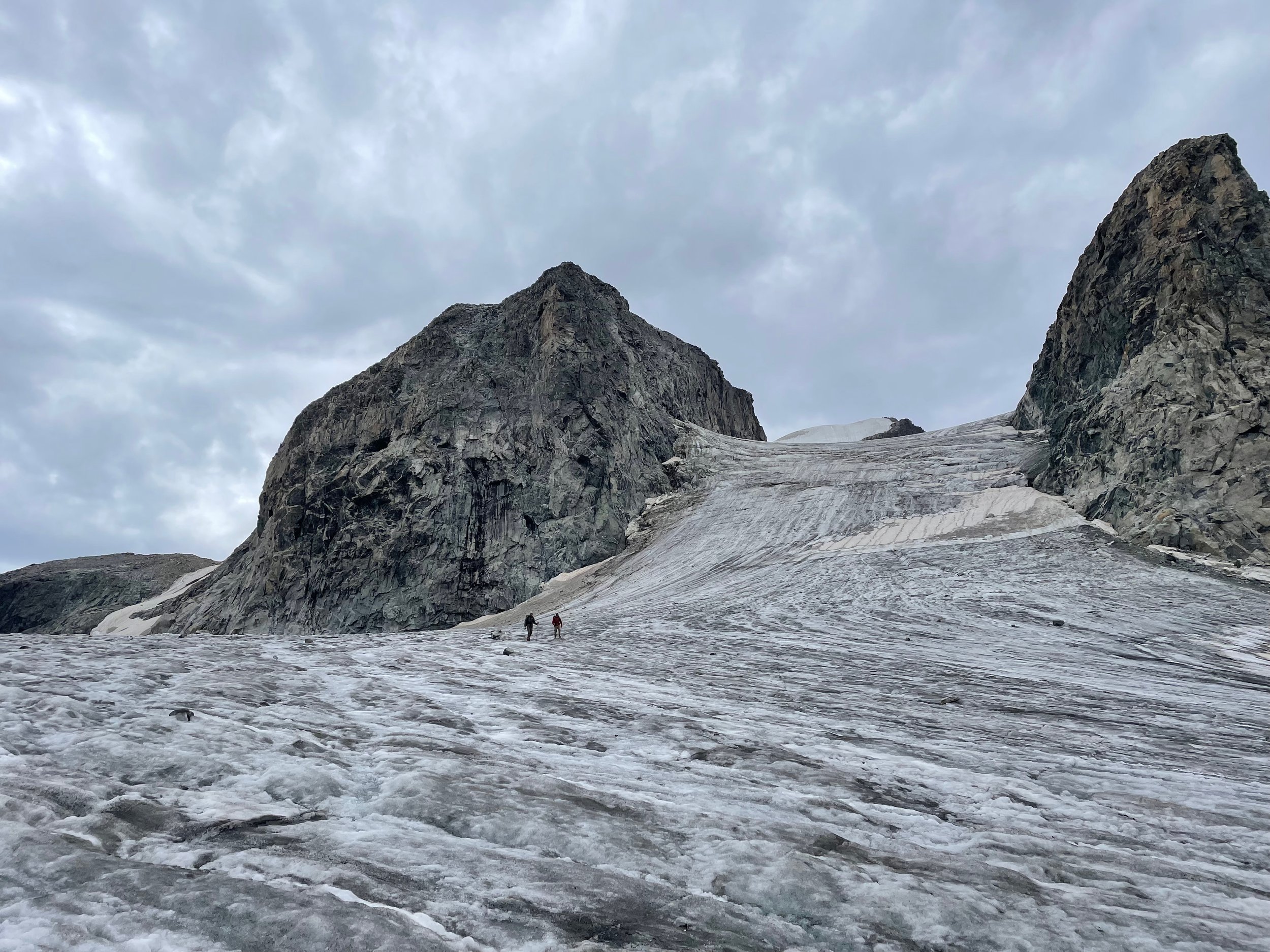
Crunch crunch crunch on the Gannett Glacier.
The beginning of day 3 meant saying goodbye to any semblance of trail, or any semblance of natural shelter/vegetation/life as we know it for at least the next two days. We rock-hopped for about an hour to the base of West Sentinel Pass, then made our way up it in fits and starts over the next hour, a mixture of boulders, talus, scree, and two small snowfields. I had specifically purchased Kahtoola Microspikes for this trip and had been lugging them around this whole time, even on the first section-hike where we never touched snow, and so was pleased to have the opportunity to deploy them—and even more pleased to find out that they’re extremely helpful on firm morning snow. A family of bighorn sheep, complete with an adorable lamb, watched us flail to the crest of the pass and step up onto the Gannett Glacier. With the help of the microspikes the glacier ended up being the most comfortable travel of the day: there was a gently sloped line across it, the only crevasses were about a foot across and very easy to spot with no snow cover, and the temperature while traversing it was around 40°F, just right for keeping the surface firm but not slick. Once across, there was an intimidating “gully” leading up to an unnamed pass overhung with a nasty-looking cornice, which we negotiated easily enough by staying on snow for the first third, transitioning to gravel/moraine/talus for the rest, and passing by the climber’s-left side of the cornice at the top; the descent on the north side was steep but generally soft enough sand to plunge feet into. This brought us, around noon, to an annotated spot we’d been eyeing on the maps for some time—“possible camps if snow-free.” We weren’t quite sure what to expect in terms of “how desperate would one have to be to camp here” but there were two good tentsites (there might have been more, I didn’t explore) and this was good enough for me in my solo tent and Andrew and Eric in their two-person. Even though the day was only halfway over, we understood that it was the one with the most marginal weather forecast and that there was probably not anywhere to camp for several more steep, slow, exposed miles, so we decided to set up shop. We spent the afternoon lazing around, alone, in our cold gray rocky aerie, recharging for a sustained push at even higher altitudes the next day.
Day 4
Eric and Andrew preparing to leave “possible camps if snow-free” at 11,500 feet.
Day 4 started with an initially steep, eventually gradual talus-hop up Bastion Peak Pass. As with countless other climbs and descents on this trip, it was hard, slow, steep, uncertain-of-foot—and that’s pretty much all one can say about it. “We got it done … eventually … somehow.” Coming down the north side of the pass was friendlier, and we were soon at the shore of the blue-green terminal lake for the massive Grasshopper Glacier. The best course of action for getting up the glacier and onto the Continental Divide was not clear, since some of the glacial slope was at a steep and snow-covered (i.e. crevasse-concealing) angle, but after probing around we eventually settled on traversing part-way to a rocky nunatak—which was fortuitous, because no sooner had we gained the flattish top of that rocky part than the weather turned dramatically, and a storm was on top of us. We got our tents pitched on flat but very exposed ground with, quite literally, not a second to spare, and rode out a classic Continental Divide mid-afternoon thunder-and-hailstorm, except it was only 11:30am.
Blue skies (the clear kind) returned within an hour, so we packed up and pressed on, up and over the remaining, highest reaches of the glacier and onto the Divide itself, where we were greeted by a flock of a dozen bighorn sheep. At this point, the guidebook said, we were above 12,000 feet and with only one brief exception would not be descending below that altitude until the coda of the hike, coming down Downs Mountain five straight-line miles away. We also had only seen one other human, a southbounder in the vicinity of the glacial lake that morning, and would only see one more before we were back in civilization a day and a half later. The sheep and the occasional salt-crazed pika (one had eaten Eric’s trekking pole wrist straps overnight) were the only other vertebrates around, as far as we could tell. I, personally, had never spent more than a few hours at a time in such an environment before this trip. I was pleased to be able to experience it and even more pleased to be, all things considered, quite comfortable—between a healthy, stronger body and appropriate lightweight gear and food, I had the satisfying feeling that even with the surprise storms and the slow, steep navigation I was Handling It All Pretty Well. The Wind River Range has a reputation for doling out Type 2 fun (not fun at the time, fun to talk about later though), but I have to say I was mostly experiencing it as Type 1. Travel was considerably faster after getting onto the Divide, with the only slowdown coming at the steep descent into the stunning Iceberg Lake Pass. We climbed out in the late afternoon and made camp at the saddle south of South Downs Mountain, before being summarily pounded by the second 100% exposed hailstorm of the day at sunset. Yayy.

Eric negotiating his perennial nemeses, the boulders, with sourdough glacier in the background and iceberg lake pass in the chasm between.
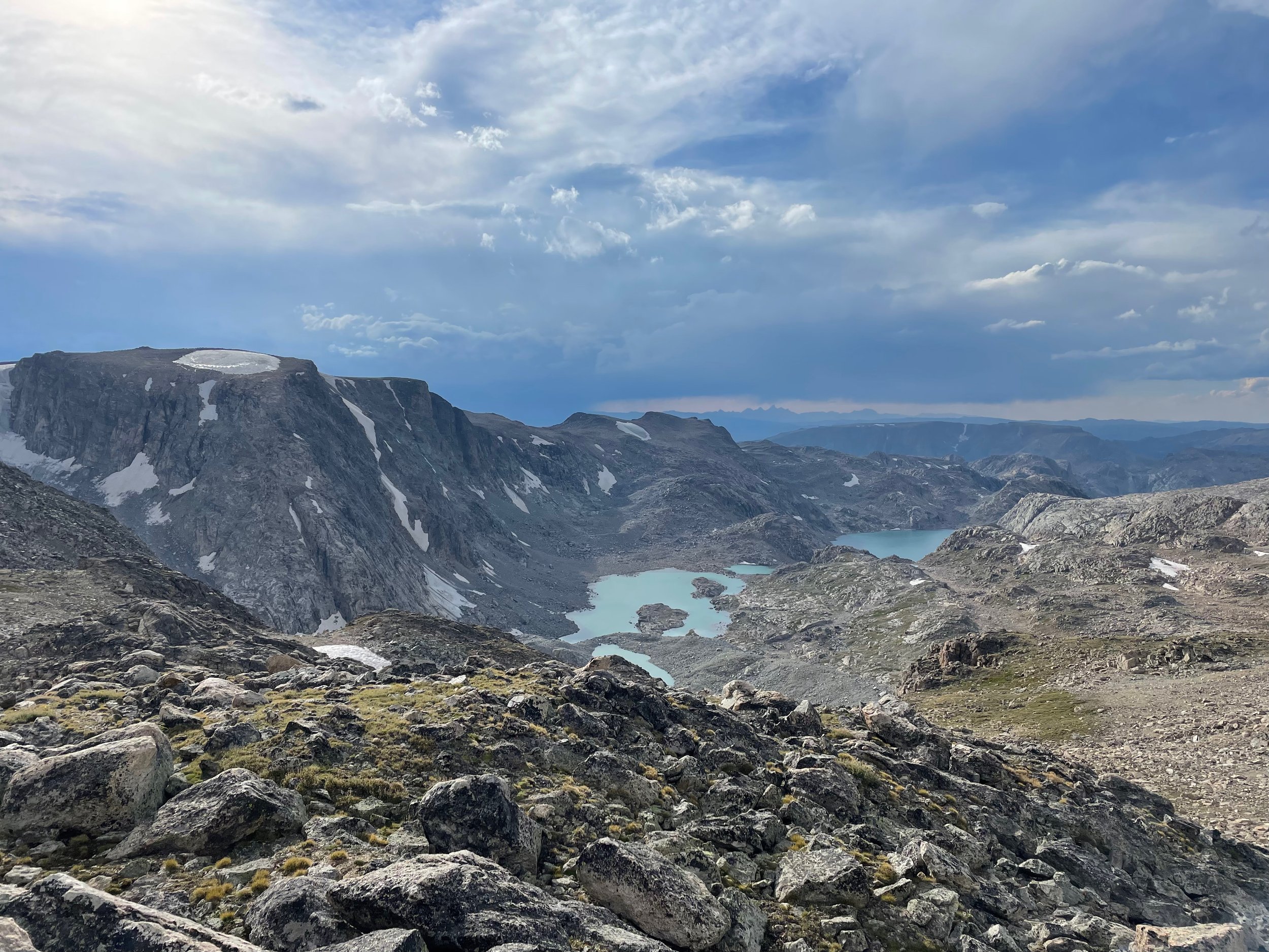
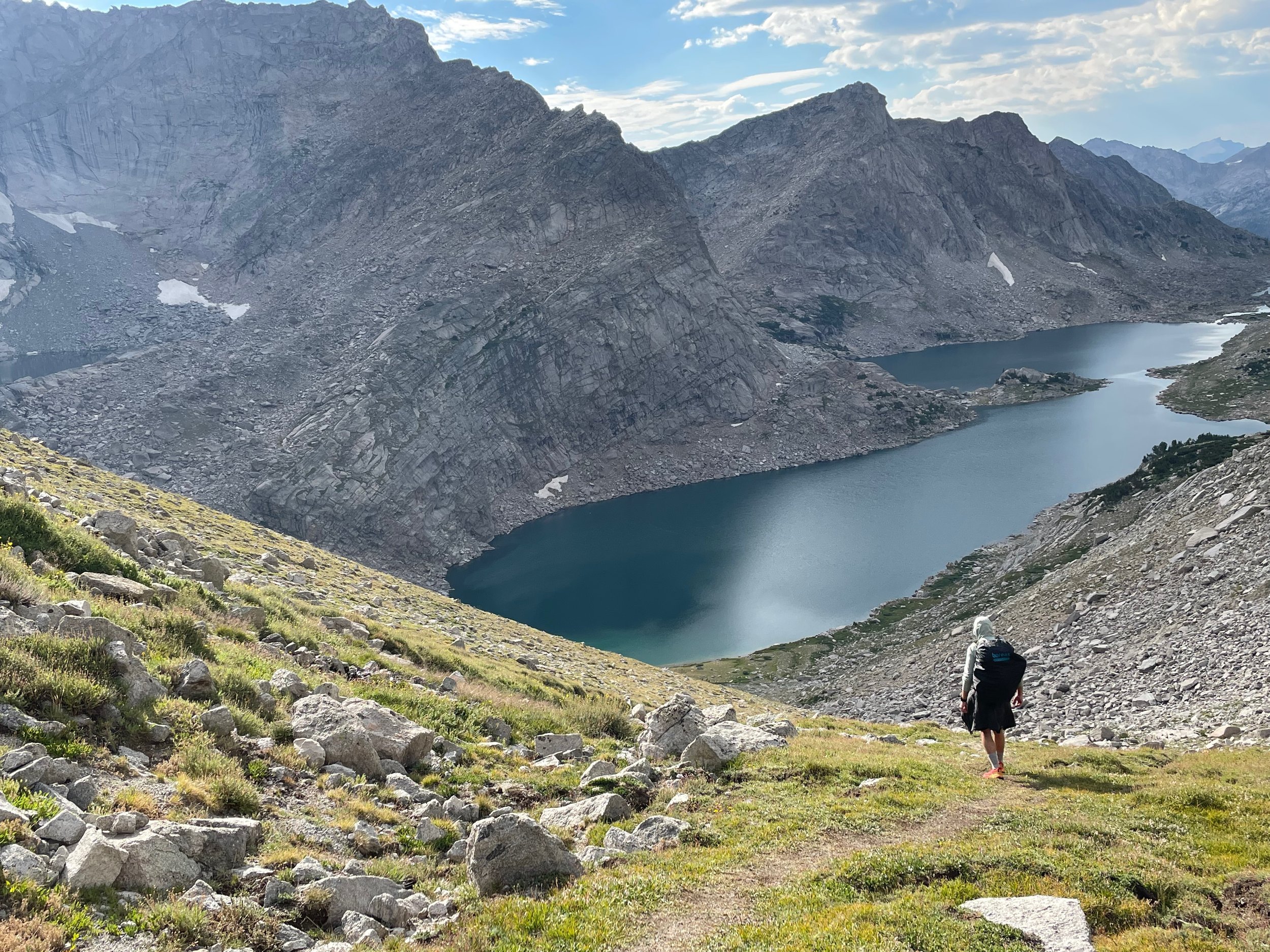
Just some lakes at the end of the day. What were they called? What are those peaks above them called? The maps make no mention.
Day 5
We blasted out of camp early on the fifth day, up and around the peak of South Downs (except for Andrew, who scurried up to tag it) and onto the “broad, lunar flat” that precedes Actual Downs. The climb to the Downs summit was only a few hundred more vertical feet beyond, nothing we hadn’t seen before at this point, and the vibes were good as we relaxed in the bluebird sun at the top, knowing that it was all downhill from here to the cars, the hotels, the Fireball shots, the amorous, easily impressed townies, etc., etc.
But wait! Downhill in the Winds isn’t always a good thing, and sometimes when you think it’s going to be downhill, it’s actually going to be straight up. We were slapped repeatedly in the face with these facts—we really should have known better at this point—on the long, pokey descent down the east face of Downs, the climb back up from No Man’s Pass, and worst of all, the absolutely mind-numbing and interminable boulder-hopping on Goat Flat as it gently sloped down over several miles toward the intersection with the Glacier Trail. The Glacier Trail was our promised land—we’d walked in on it four days prior, and knew it to be extremely easy going, especially in the downhill direction, because of its excellent construction. Unfortunately, around 4:30pm on the windward of an unnamed “craggy spur – no good side” (note from the topo map) still above treeline on Goat Flat, we were once again overtaken by bad weather and had to make an emergency camp to ride it out. In my solo tent, I had assumed this was where we would be ending our day, but as the rain let up around 6:30 Andrew walked over to announce that, regardless of darkness, he and Eric were planning on making it to the trailhead that night. My instinct was that this was not the right move, but I went along anyway and it worked out fine: with the weather past we were on the comfortable, already-visited trail by the time it got dark and only had to use headlamps for about two hours before reaching our cars. It was a hasty end to a trip that had been marked by enforced patience at pretty much all other times. I have no further parting thoughts, at least so close to the event. Speaking for myself, I loved the Winds, was completely blown away by their scale and intensity, and intend on coming back for more at some point in the future.
Andrew overlaid our actual track on the CalTopo tracks for each loop, and those can be found here.

The author atop Downs Mountain on the last day, foolishly letting his guard down and thinking the work was all but done at that point.